Anton Schönborn, 1829-1871
chief topographer
|
"'Schönborn is a capital Topographer. He is perfectly at home with his instruments. I question very much whether King has any one connected with him that will equal Schönborn. I do not think he has had a fair chance before. He has fixed the Longitude and Latitude of this point, taken all the elevations needed, and he proposes to map a belt--50 miles in width--to Fort Ellis, before commencing our systematic work." [1]
"Henry Elliott made drawings along the whole route, while Schönborn summarized the topography and Hayden sketched the geology."[3]
|
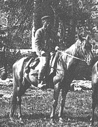 "Anton Schönborn" [2] |
|
"The loss of my chief topographer, Mr. Anton Schönborn, whose death occurred at Omaha after he had returned from the trip, with the notes which he had taken with zeal and ability, seemed almost irreparable. On my arrival at Washington I applied to Prof. J. E. Hilgard, the able assistant in charge of the United States Coast Survey Office, for aid in my extremity. With his usual sympathy and prompt action in all matters pertaining to science, he at once placed Mr. Schönborn's field-notes into the hands of the Coast Survey, and the result has been that Mr. Hergesheimer has compiled and drawn a series of maps and charts of the survey, whose beauty and accuracy attest his skill as a topographer. Prof. Renuel Keith, of the Coast Survey, computed the observations for latitude and time. Mr. Beaman has been permitted to consult from time to time with Mr. Charles A. Schott, in the preparation of the meteorological report. I cannot too earnestly express my obligations to the officers of the Coast Survey for their aid and counsel." --F. V. Hayden [4]
|
"He [Hayden] tore open the telegram. The first word he saw was suicide. His stomach lurched. It was Anton Schönborn, his old friend and topographer. Schönborn's housekeeper had found him in his room at Omaha House, where he had lived for the past three years. He had departed this life with a violent gesture: he'd cut his throat. . . . When they first met, Schönborn was Captain Raynolds's artist and topographer. They got along well. They were the only two Germans in the party, and Hayden thought that might have made a difference. On that trip, Hayden learned that Schönborn had a university degree and spoke five languages." [5]
|
To the best of my knowledge no one has found Schonborn's field notes, or any evidence of how they were translated by the Coastal Survey. Elevations cited in Peale's diary often differ from the same elevations listed in Hayden's report, and some of these differ with elevations appearing on Hayden's official map. Peale, for instance, calculated the Lower Falls at 400 feet when they are measured today at 308. The 1869 and 1870 expeditions came much closer using their balls of twine, with findings of 360 feet and 350 feet, respectively. In Hayden's report their height is listed at 350 feet." [6]
- Fedinand Hayden quoted in Merrill, Marlene. With Hayden in the Field : a Case Study Based on Unpublished Letters and Diaries from the 1871 Yellowstone Survey. 1993. Yellowstone Research Center Archives.
- David Michael Delo, The Yellowstone, Forever! (Helena, MT: Kingfisher Books, 1998), pg. #358.
- USGS Photographic Library, http://libraryphoto.cr.usgs.gov/index.html
- Mike Foster, Strange Genius: The Life of Ferdinand Vandeveer Hayden (Niwot, CO: Roberts Rinehart Publishers, 1994), pg. #208.
- F. V. Hayden, Preliminary Report of The United States Geological Survey of Montana and Portions of Adjacent Territories; Being A Fifth Annual Report of Progress (Washington: Government Printing Office, 1872), pg. 5-6.
- Merrill, Marlene. With Hayden in the Field : a Case Study Based on Unpublished Letters and Diaries from the 1871 Yellowstone Survey. 1993. Yellowstone Research Center Archives.